Robert's Ramblings is my place to show my passion for this amazing world.
Images, words and insights are my way of sharing that passion.
Welcome to my blog.
Monday, December 8. 2025
Eire 80
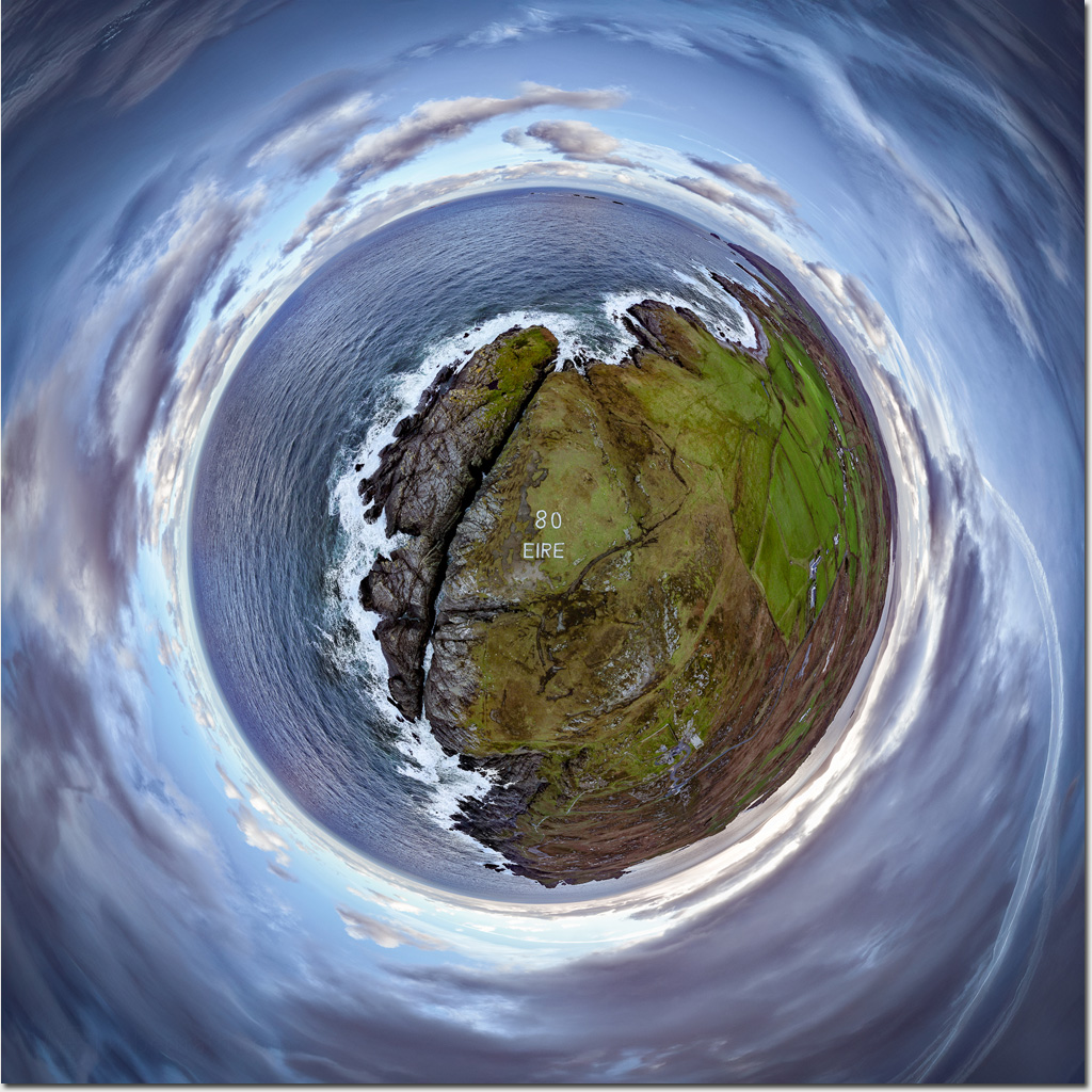
Eighty years ago, a large whitewashed “80 EIRE” sign was cut into the rock at Malin Head on the Inishowen Peninsula, Ireland’s northernmost mainland point.
This sign, along with more than 80 others around the Irish coastline, was created to warn Axis forces that they had entered neutral territory and to serve as a navigational aid for Allied pilots.
Today, many decades after World War II, most of these signs have fallen into disrepair, with fewer than a quarter still visible. Malin Head’s unique position—and its long-standing role in maritime history, weather forecasting, and more recently, tourism—has ensured its upkeep and continued visibility.
If you find yourself on the Inishowen Peninsula and the weather is clear, make your way to Malin Head. Walk out onto the rocks, pause by the old marker, and reflect on 80 EIRE and what it represented all those years ago. Then get back to your car quickly, before the weather changes its mind and blows you halfway back down the peninsula.
#Ireland #InishowenPeninsula #TinyPlanet #MalinHead #Eire80 #travel
Trackbacks
Trackback specific URI for this entry
No Trackbacks
Subscribe To My Posts
My Networking Sites
Twitter Updates
Calendar
|
|
July '26 | |||||
| Mon | Tue | Wed | Thu | Fri | Sat | Sun |
| 1 | 2 | 3 | 4 | 5 | ||
| 6 | 7 | 8 | 9 | 10 | 11 | 12 |
| 13 | 14 | 15 | 16 | 17 | 18 | 19 |
| 20 | 21 | 22 | 23 | 24 | 25 | 26 |
| 27 | 28 | 29 | 30 | 31 | ||
Quicksearch
Categories
Syndicate This Blog

Blog Administration
random pics